Subsidence is the gradual sinking or settling of land, often caused by groundwater extraction, soil compaction, or underground mining. Knowing about recent subsidence is critical for a land buyer because it can damage foundations, reduce property value, and increase flood risk. SAR (Synthetic Aperture Radar) data helps detect these changes over time, ensuring the buyer avoids unstable or high-risk land.
How subsidence is measured
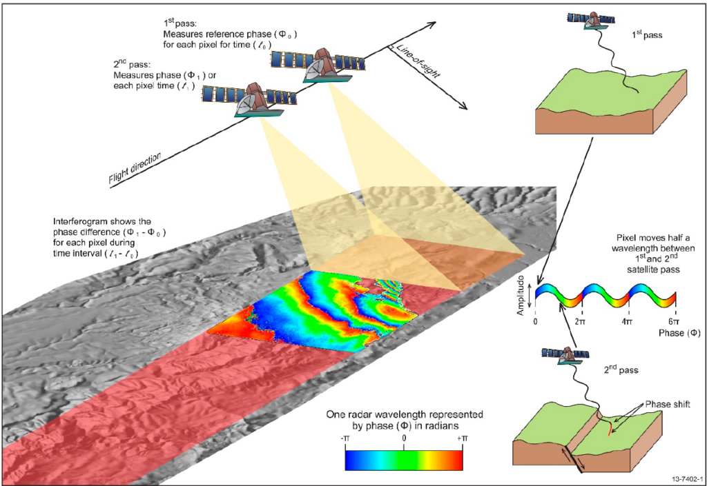
Subsidence is measured with InSAR (Interferometric Synthetic Aperture Radar) using Sentinel-1 satellite data, which detects millimeter-scale ground movement by comparing radar phase differences over time. This method is cost-effective, wide-coverage, and non-invasive, making it ideal for monitoring large areas like cities or agricultural land.
Minderhoud et al. (2018), Remote Sensing for the Quantification of Land Surface Dynamics in Large River Delta Regions—A Review
Aspect
Why It Matters
Structural Integrity
Prevents damage to buildings, roads, and infrastructure due to uneven settling.
Flood Risk
Subsidence can lower land elevation, increasing vulnerability to flooding.
Property Value
Areas with active subsidence often see reduced property values and higher insurance costs.
Resource Management
Helps manage groundwater extraction, oil/gas mining, or peat oxidation impacts.
Legal/Regulatory
Compliance with local building codes and environmental regulations.